
A peak, loads of gorgeous trails, mountain streams, and (at least) six big waterfalls. This long loop starts in Wulai, climbs to Dadaoshan via the Laka Trail, then joins up with the Neidong Forest Road. The road starts out wide but later turns into a gentle, narrow forest path that goes all the way to Doll Valley and the Neidong Forest Recreation Area. At the Neidong National Forest Recreation Area the route passes three huge waterfalls and then continues on the Xinxian Trail, where there are more falls. Lastly it follow the riverside road back to Wulai passing the giant Wulai Waterfall.
 |
| Neidong Forest Road |
Distance/Time: 7 hours 18 mins/ 20 km. A map and more details can be found here
The Trail:
None of the trails on this hike are difficult but it's length bumps it up to the level of a hard hike. It's suitable for fit hikers that have the stamina to walk 20 kilometers. But there are some options for making it shorter (see below).
The roughest part is the Laka Trail which climbs steeply to Dadaoshan. This part could be really slippery when wet. But once Neidong Forest Road is reached, it is gentle and relatively level for the rest of the way--with just a few muddy places. This is the longest section of the hike and in my opinion the nicest. It starts out as a wide gravel road but after a traffic barrier it narrows to a path through the forest. At times it it seems jungle-like. Other times there is alpine-like coniferous forest. Other sections reminded me of temperate North American forest.
There are several places where landslides have covered the trail but they all look like old slides, there are established paths going over or around them and they are not hard to negotiate.
In the Neidong National Forest Recreation Area the walk is on well-groomed tourist trails or paved paths. The final part follows the road back to Wulai. There is a pedestrian area next to the road that is separated from the traffic by a barrier and on the day I was there the traffic was not heavy. There is one short tunnel on the road with no designated area for walkers.
The village of Wulai which lies sixteen kilometers from Xindian beside the Nanshi River is famous for Atayal aboriginal culture, food and hot springs. It's an easy trip to the countryside from Taipei and a great place for sightseeing, having lunch or shopping on the main tourist street. Wulai is usually crowded but as usual in Taiwan, once you leave the popular areas, you are unlikely to see many other people.
Dadaoshan 大刀山 (620m) has a flat summit and no view. The Laká trail starts near Wulai, climbs over the summit and then down the other side.
Neidong National Forest Recreation Area is a beautiful 1191 hectare park near Xinxian village. It's main attractions are its numerous waterfalls, bird life and wild mountain and river scenery. There are well maintained walking paths and it's a great place for families and casual hikers. Doll Valley is an area within the park on the Xinxian stream which feeds into the larger Nanshi River.
Xinxian Trail is a short, paved walking trail that follows the Nanshi River. It begins near the Xinxian Experimental Elementary school and ends where the Xinxian Suspension Bridge crosses the Nanshi River and meets the main road to Wulai. It passes a series of cascades formed by rivulets flowing down the hill into the river.
There are several waterfalls at the end of the walk:
Neidong Waterfall in Doll Valley consists of an upper and lower falls. Both are huge waterfalls of white water with ice-blue pools at the bottom.
Unfortunately you can't really get too close to them but they are still an impressive site from a distance. Access is cut off by a railing and signs prohibiting entry.
Wusha Creek Falls is a very tall, thin cataract of white water that lies on the other side of the Nanshi Xi where the Wusha Xi flows into it. There is a viewing platform that gives a clear view of the falls from across the river.
There are a series of cascades along the Xinxian trail but on the day I visited most were just a trickle. the exceptions were the last two. One, just called "waterfall" on my map, was a stream of water sliding and dripping over a huge, slick rock face. The last one, Shenglong Waterfall, is a nice medium sized falls and you can go right up to the base of it.
The final waterfall is the famous Wulai Waterfall which plunges 80 meters down a cliff. It's a huge tourist draw and even after seeing it many times it is still an impressive sight.
Options for a shorter walk:
At the top of Wulai Falls there is a theme park called Yun Hsien Resort. You could walk just the Laka Trail and Dadao Shan and then walk in the "back door" of the park. Then take the cable car that runs from the top of the falls down to the viewing platform below. Many hikers do this and I've done it a couple of times before. If you go in the park the back way you don't need to buy a ticket but you do need to pay for the cable car. I don't remember the cost. This walk is described in detail Richard Saunders' book Taipei Escapes 2.
At the end of the walk you could skip the Xinxian trail and the walk on the road and get a taxi back to Wulai instead. At the Neidong Forest Recreation Area parking lot it would not be hard to hail or call a taxi on a weekend.
What to bring:
I packed snacks, lunch and took two one liter bottles of water. I knew that if I ran out there would be places to get water on the trail. I always filter water from streams or treat it with iodine.
I recommend wearing long pants since some parts of the path are narrow.
There are plenty of shops in Wulai where its possible to buy snacks or drinks both before and after.
Transportation:
Bus
849 goes from Xindian MRT Station to Wulai and back. The buses come every 15
minutes and take about 30-40 minutes. They stop in the parking lot just before the village.
The hike:
I set out by myself on a day when the weather was predicted to be 15 - 25 degrees Celsius with zero percent chance of rain--very good hiking weather. I got off the bus at Wulai and started hiking at 8:30. I passed the Family Mart, crossed the bridge over the Tong Hou River at the main entrance to the village and immediately turned left onto route 9.
In about ten minutes, I passed an elementary school and then came to a fork with a clear sign saying the Laka Trail was 0.46 km along the right fork.
 |
| Left toward the Tonghou trail, right toward the Laka trail |
I followed the right fork uphill and around a bend, took a short-cut up some steps, turned left on the road at the top and then came to the trail in the corner of a group of houses. This took less than ten minutes. There was a barking dog but he was chained and did not seem very aggressive.


The trail started out relatively easy. It was very nice walking. I could hear the hum of activity from Wulai below.


After around 30 minutes I came to a fork. A hand lettered sign in Chinese pointed toward Dadao Shan. I took the right fork climbing up wooden and earth steps. Here it became more steep.


In 20 minutes I came to a T-intersection. A pair of hikers, a man and woman, where resting there.

We talked a bit and they told me there was a group of twenty some people ahead of me. I turned right again. I came to an opening where looking back I could see the Nanshi River and the parking lot from which I had started.

I came to a narrow ridge ribbed with tree roots. Then after a short, steep climb reached the flat summit of Dadao Shan (620m), at 10:00 am, just an hour and a half after starting to hike.


Behind and to the left of the summit was a shed with a tower. I continued straight past the summit, with the the shed on my left.

Now the trail went downhill gradually. This was a really nice section of trail which I followed for another twenty minutes until I came to the Neidong Forest Road.


There was a white car parked at the side of the road and I saw a lone hiker on the road. I thought it was his car but he said it wasn't. He was heading back but he told me a few details about what to expect on the trail. He told me it would take three hours to get to Neidong Forest Recreation Area which would turn out to be exactly right almost to the minute including a short stop for lunch.
While I was talking to him two young men riding dirt bikes drove by and disappeared down the road.
Just next to where the Laka Trail intersects the road is another trail angling back into the forest. This trail goes to the amusement park at the top of the falls. The large group (which I never saw) had gone that way because I could hear their bellowing fading away in that direction.
I turned right and set out with a feeling of euphoria. It felt really good to be walking on a wide, relatively flat trail, free to gaze around at the surrounding forest. I love the climbing and scrambling that is common on hikes in Taiwan but sometimes it's really nice just to put one foot in front of the other and not have to watch your feet all of the time.
I passed another car at the side of the road where a couple had set up a camping table and chairs under an awning and were having a picnic.


About 30 minutes of road walking brought me to a bridge over a rocky stream bed with stepped weirs.

Around the next bend was a traffic barrier. Beyond the barrier the road became a trail.


In another twenty minutes I passed a fainter trail on the right. It looks like this trail also leads to the theme park but I have not gone that way.
Soon I came a landslide of wet, red clay. This was the freshest looking of the obstructions I would see all day. I climbed up and and over. The motorcycle riders had also passed this way because I could see their tracks in the mud.

Sometimes I could hear the engines of the dirt bikes or see their tracks and eventually I would catch and pass them while they were taking a rest. Near the end of the trail there were some very narrow parts that would be hard to negotiate on a motorcycle so I think they eventually turned back.


At 12:00 I passed a simple campsite and filed it away in my mind for a future camping trip.


From here it was about another hour and a half to the Neidong Forest Recreation Area.


Just before reaching Doll Valley and Neidong there was a fork.
 |
| I bore left at this fork. |
It's possible to take the trail on the right down to the Xinxian trail and make the walk shorter but it would mean missing the two Neidong falls and the Wusha Creek Waterfall so I went left.
This was another really gorgeous trail.

In less than ten minutes I came out to the Neidong National Forest Recreation Area. The trail zig-zagged downhill gently. This was a area of well-kept trails and right away I started seeing more people. Hikers in casual clothes out for a short stroll and families.

At the bottom of the hill I took the left fork next to a shelter house. A sign pointed toward the lower waterfall. The right fork zig-zags downhill and comes out across the stream from the Wusha Creek Falls.


Eventually the trail led down wooden steps and I came to the viewing platform for the upper Neidong waterfall with it's rushing white cascade and blue pool. Then I passed the lower falls. Further downstream I got a glimpse of both waterfalls from a bridge over the river.
 |
| Upper Neidong Waterfall |
 |
| Lower Neidong Waterfall |

The paved path continued next to the river and in about 30 more minutes came to the viewing platform for the Wusha Creek Falls, where the Wusha Creek flows in to the Nanshi River.


 |
| Looking back at the ticket booth |


The last two where the most notable.
 |
 |
| Shenglong Waterfall |
After passing over the Xinxian Suspension Bridge, I reached the road leading back to Wulai and turned right now on the other side of the river.


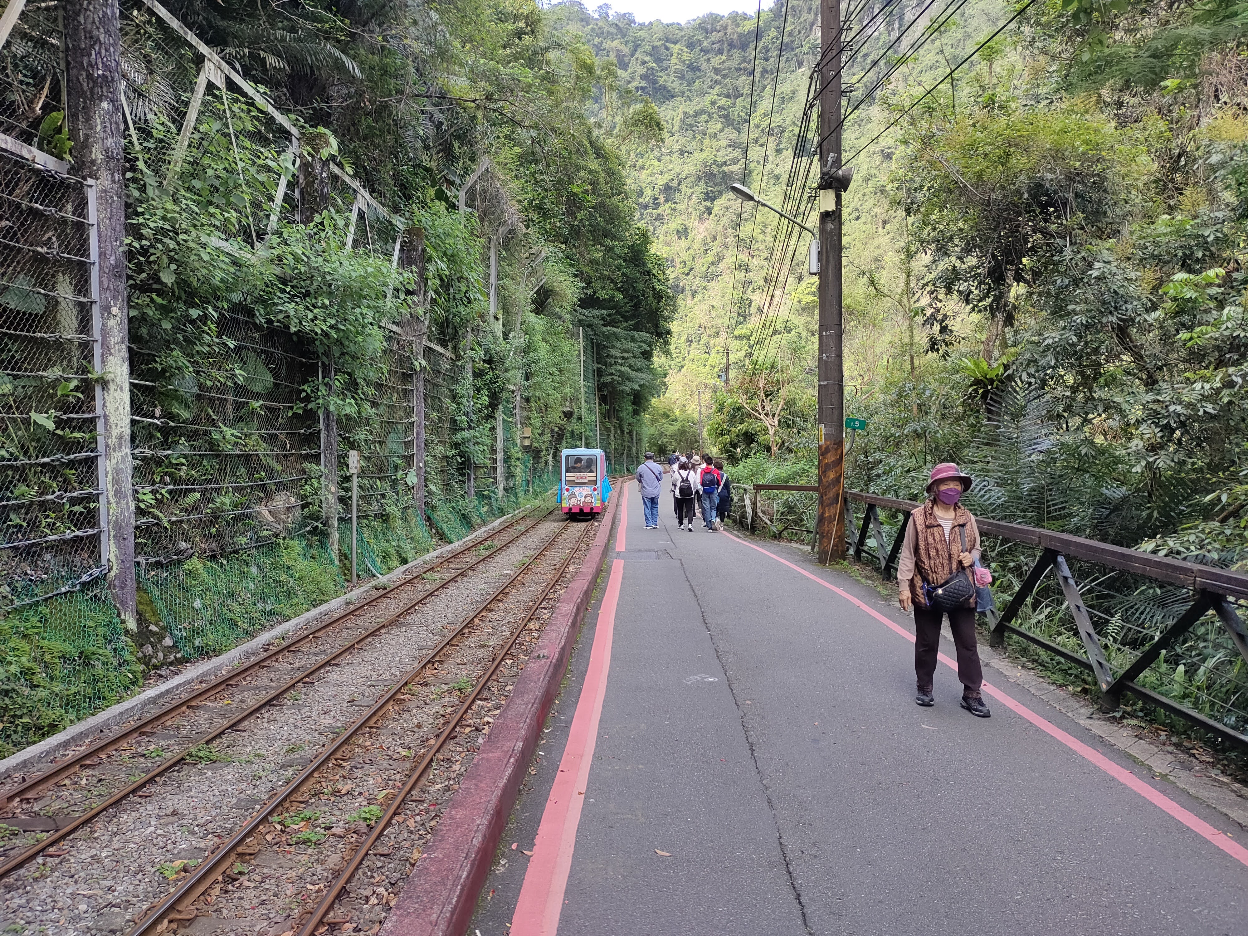
It took about 50 minutes to walk back to where I had started in Wulai passing the big Wulai waterfall, the mini-train and the main tourist street of Wulai on the way. At the Wulai Waterfall viewing platform I stopped for a cold drink. There are lots of restaurants and shops selling drinks and snacks near the viewing platform and in the main part of the town.


Wulai 8:30 - Dadaoshan 10:03 - Neidong Forest Road 10:23 - Doll Valley/Neidong National Forest Recreation Area 13:22 - Xinxian Trail 14:39 - Road to Wulai 15:00- Wulai Parking lot 15:48
Other nearby hikes:
Wulai to Yilan: Ayu Road and the Tong Hou Trail 桶後越嶺步道
A Yu Road and the Tong Hou River Primitive Campground 桶後溪營地
Subscribe: To get new posts by email you can subscribe here Subscribe or follow Taiwan Hiking Journal on Facebook
Map and GPS coordinates:
Laka Trail trailhead: 24.860492, 121.553701
Dadao Shan 24.850909, 121.55839
Neidong Forest Recreation Area parking lot: 24.834913, 121.526878
.png)
No comments:
Post a Comment