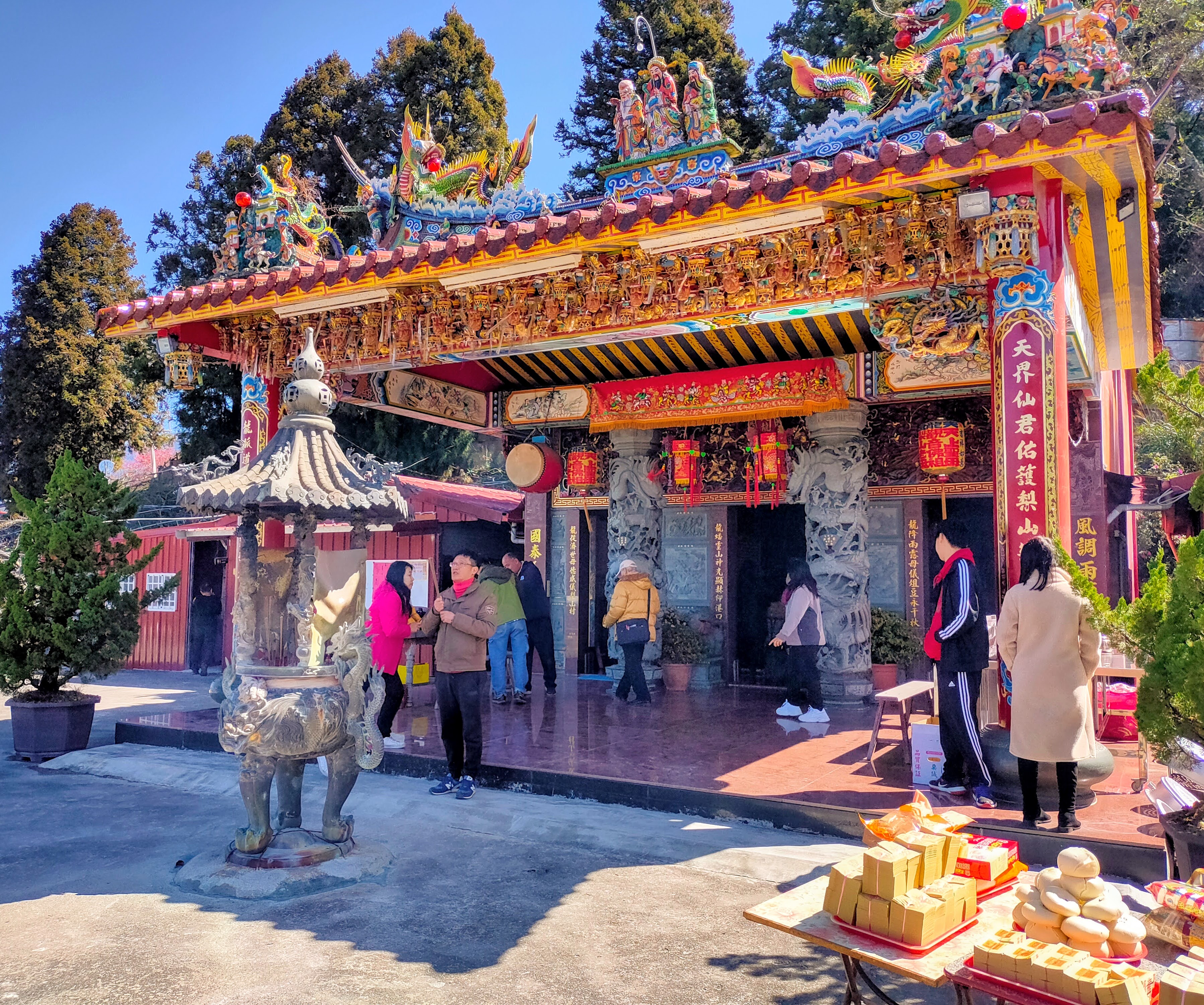
 |
| View at the beginning of the Ping Feng Mountain Trail |
Ping Feng Mountain is a 3,248 meter peak in Taiwan's Northern Central Range. It takes 2-3 days to walk the route though 3 days is more enjoyable. The steepness of the terrain makes it a challenging walk but the trail is easy to follow and generally stable. Hikers drop into a thickly wooded river valley, climb up the other side to the peak and return by the same route. There is no view from the peak but there are views on the way up and an excellent view point just a few minutes beyond the summit. Hikers can stay in the Ping Feng Cabin or tent camp at the Pine Needles Campsite which is spacious and flat and has a water source nearby. No permits are needed but a reservation is required for the cabin. Ping Feng Shan is number 65 of the Baiyue--the 100 Mountains of Taiwan.
 |
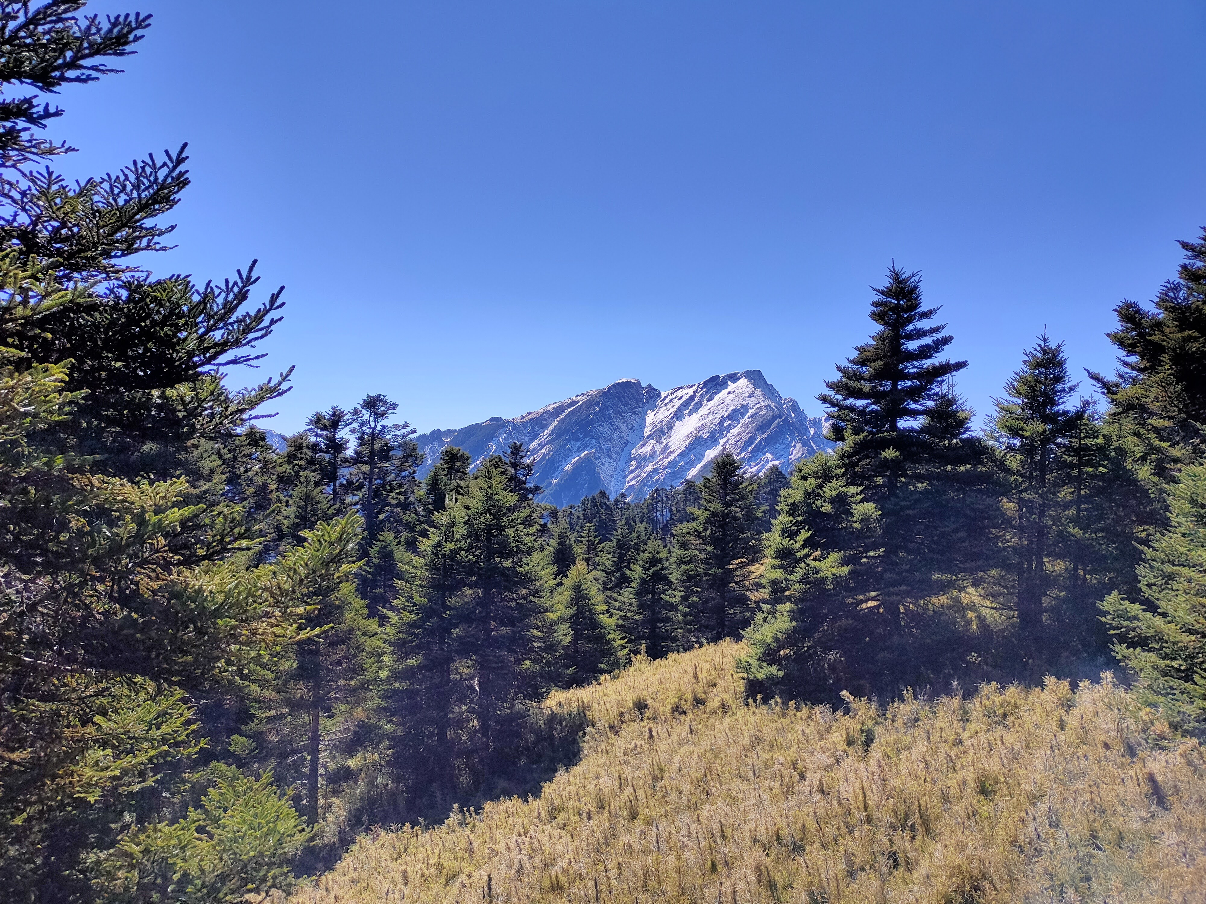
| Looking toward a snowy Qilai North Peak from near the summit of Ping Feng Shan |
Distance/Time: I walked 14 km over three days. More details as well as maps can be found by following the links to my ramblr account, next to each day.
Day 1: Dayuling to the Pine Needles Campsite, 4.1 km/ 2 hours 42 mins http://rblr.co/ooCdP
Day 2: Pine Needles Campsite to Ping Feng peak and back, 7.1 km/ 7 hours 49 mins http://rblr.co/ooCdW
Day 3: Pine Needles Campsite to Dayuling, 2.9 km/ 2 hours 37 mins http://rblr.co/ooCdc
What to bring: I took my stove and cooked breakfasts and dinners but ate snacks on the trail during the day. Warm clothes and a warm sleeping bag are essential.
If you stay in the cabin you can save weight by not taking a tent but when I went the cabin was booked. I will give more details about the cabin in the section describing the trail below.
I took a small summit backpack for the climb to the peak.
I recommend taking a container for fetching water back to the camp. The water source is a few minutes walk away, up and over a hill. I took a large collapsible Nalgene canteen. The stream which is the water source has plentiful, clean, moving water that was fine to drink after boiling.
The Trail: The trail begins near the tiny community of Dayuling in Xiulin Township, Hualien. It is considered a challenging route due to the steepness of the terrain. There are four mountains in this area known as the four "spicy" mountains. "Spicy" in Chinese referring to strenuousness. Pingfeng Shan is considered the second most "spicy" of the four after Baigudashan.
In
the past there were several accidents and even deaths mostly due to a part of the trail that was unstable. However, the trail was rerouted a few years ago
to avoid this dangerous area and the old trail is now closed.
The trail descends steeply into a V-shaped forest valley, crosses two streams and then climbs up slightly to the campsite. It starts at 2500 meters drops down to a low of about 1930 meters at the bottom of the valley and climbs to the peak at 3,248 meters. From the campsite to the peak and back hikers walk 1200 meters up and 1200 down. It is a steep, challenging walk. However, hikers who are fit and mentally ready for the challenge should be fine. The trail is mostly easy to follow and the footing is good. There are a few areas where there are steep climbs using ropes but not as many as I expected.
The trail passes through mixed deciduous and coniferous forest which gradually becomes almost exclusively coniferous as the trail wends its way higher. I spotted a few huge, old cypress trees that in Taiwan are referred to as "god trees." There are two bridge-less stream crossings. I was able to cross without getting my feet wet, but of course, that could change after heavy rain.
There is a new hut at the Pine Needles Campsite that was built about two years ago as well as an eco-toilet. As you enter the hut, there is a communal cooking area with benches and tables in the middle and bunks to the left and right. There are a couple or picnic tables outside of the hut.
 |
| Ping Feng Cabin |
You can book the hut through the national parks website: https://npm.cpami.gov.tw/en/apply_1_2.aspx?unit=105e956f-d8da-49f7-a9b7-3aefdda88a12
-Ping Feng Shan is in Taroko National Park so be sure to choose Taroko from the menu on the left.
-You do not need a national park permits for this trail but the same site is used for booking the huts.
-The hut sleeps 28. You can check how many spaces are available on a given date here: https://npm.cpami.gov.tw/en/bed_4.aspx
-the hut can be booked from 2 months to 5 days before the trip
Even though the hut was fully booked, the campsite did not feel crowded. Most of the time hikers were out on the trail and in fact some people who made reservations did not show. On the first night there were two tents outside. On the second, mine was the only tent.
Transportation: I took public transportation to the trailhead which was an adventure in itself. I first took a 5:35 am Kamalan bus from the Taipei Main Station bus station (in the Q Square mall) to Luodong, Yilan. It arrived in Luodong at 6:50.
I then took King Bus (Kuo Kuang) 1764 at 7:00 am from Luodong to Lishan. I expected it to take 3 hours but it took four.
I planned to take bus 1141 which leaves Lishan at 10:30 am and goes through Dayuling on it's way to Hualien but the bus from Luodong arrived too late and I ended up hitchhiking from Lishan to Dayuling.
Staying in Hualien overnight and taking the morning bus is a possibility. The 1141 leaves Hualien at 5:10 am and passes through Dayuling on it's way to Lishan. It also passes through Xincheng after leaving Hualien-- stopping at the Xincheng Junior High School and Beipu Train Station-- so finding a place to stay the night in Xincheng might be an option, too.
On the way back my plan was to either hitch the short distance back into Lishan and take the 1:00 bus to Luodong or to catch the 1141 bus to Hualien, getting off near Xincheng and taking a local train back to Luodong or Taipei. But in the end I got a ride to Taipei with two other hikers.
Subscribe: To get new posts by email you can subscribe here Subscribe or follow Taiwan Hiking Journal on Facebook
Day 1: Trailhead to Pine Needles Campsite (4.1 km/ 2 hours 42 mins): During Chinese New Year 2024 I set off for Ping Feng Shan. The long bus ride from Luodong to Lishan went by quickly. I did a little reading but because I was drowsy from waking up early I mostly just dozed and looked out the window. The landscape between Wuling Farm and Lishan was particularly dramatic. The hillsides were extremely steep and the bus seemed at times to be perched precariously high above them. Amazingly, most of the precipitous hills were under cultivation.
As we were leaving Wuling Farm, I realized that we were not going to make it to Lishan in time to transfer to bus 1411. After 10:30, I checked the BusTracker Taiwan app and could see that the bus had already departed. But I was high in the mountains and free from work and other obligations for a few days, so I decided to just relax and enjoy the ride. The worse that could happen was that I would find somewhere near Lishan to camp for the night.
We arrived in Lishan at 11:00. I asked at the Lishan Visitors Center and they said there were no other buses going to Dayuling and no taxis. Dayuling is relatively close to Lishan but it is 27 kilometers away and not walkable. So, I tried plan C. I went to the edge of the town and tried hitchhiking. It was the Chinese New Year holiday and there were lots of cars passing through.
It is not uncommon for me to hitchhike in Taiwan. I almost never fail to get a ride. Taiwanese people are amazingly helpful and open to picking up a foreign stranger at the side of the road. I have gotten used to it being so easy but I never want to feel entitled and always want to appreciate it. In this case, a car stopped in less than 5 minutes.
A woman got out of the passenger side and asked where I was going. She said her husband was bored during the holiday and he also liked hiking, so he would take me. His English name was Gary. He was 50 years old and his family lived in Kaohsiung but his wife was from Lishan and they were visiting her parents. First we made a stop at a Matsu temple which she said was the highest temple in Taiwan. At the temple I met their 20-something daughter who was a university student and their 15 year old son.
On the ride to Dayuling it was just Gary and I. His English was pretty good but eventually we settled into talking in a mixture of English and Chinese. After about 30 minutes, he suddenly said calmly, "Oh, the car has a problem." He pulled over to the side of the road. The engine had stopped. He popped the trunk and tried re-starting the car but the battery was dead. He called a friend in Lishan and we settled down to wait. After about 30 more minutes two guys in a van showed up and gave us a jump. We set off again.
However, after a while the car slowed again and was having trouble making it up hills. We went through a one lane tunnel with only room for one car to pass and it seemed like the car was going to stall inside the tunnel. Gary was saying, "Come on. Come on." And I was thinking the same--picturing us stuck in the tunnel obstructing traffic. Mercifully, we made it through and he pulled over to a parking area on the other side of the tunnel.
This was Dayuling. The trailhead was further down the road but I was close enough now to walk. I needed to get going to make sure I got to camp before dark. I gave Gary my thanks and my apologies. I was feeling very guilty. If it weren't for me, after all, he wouldn't be stranded at the side of the road but there wasn't much I could do to help him. I supposed he would have to call his friend again.


The first part was very steep downhill and was hard on my knees with a full pack pushing from behind.

It didn't take long to come to the first stream crossing. I was able to cross without getting my feet wet.
 |
| First stream crossing |
On the other side the trail climbed up a rock slide but it was stable. Halfway up the slide, the trail turned left. I climbed up a stony incline and after a while was back on a dirt path.


There was a bridge over the next stream. It was in a very pretty, deep, rocky gorge.
 |
| Small campsite just after the second stream crossing |
I hiked through a long straight corridor of trees next to the river gorge, came to a flat area of scattered trees and emerged at the campground.


After a rest, I set up my tent. It was cold so I made some ginger tea.
 |
| Home for two nights |
There were a few people in the hut and later a few more came down from the peak. I talked to two women who were hiking together and to a young couple. They asked the usual questions: Are you by yourself? Where are you from?... I told them my bus and hitchhiking mis-adventures on the way to the trail.
The women, Sarah and Shi Wen, said they were going back to Taipei on the same day as me and offered a ride. At first, I declined to be polite but they told me to think about it. The next day, I would end up accepting after they offered a couple more times.
Amazingly, I would find out later that Sarah lives just two bus stops away from where I live and that she is friends with my wife's co-worker. We talked in Chinese but much later on the drive home, I discovered they both spoke English well. Sarah had just come back from California, where she had taken an English course at UC Davis.
There was a Reeves-Muntjac deer that kept coming into camp. I was excited to see it the first time but later it came back again and again. It seemed to be enured to the presence of people.
I made dinner--noodles with some soup and chicken. I had not eaten much all day and knew I should eat to keep my energy up for the next day, but I did not feel very hungry and in fact felt a little nauseous. I ate some of the noodles but couldn't get much down. I ended up throwing most of it out. I went to sleep some time between 7 and 8.
Day 2: Pine Needles Campsite - Ping Feng Shan - Pine Needles Campsite (7.1 km/ 7 hours 49 mins): I got up around 5 am. It was cold enough outside to make me shiver and to make my hands ache if I had my gloves off for long. There were slivers of ice in the water reservoir I had left outside the tent and the threads in the cap were partially frozen.
Even though I got up early, I took my time getting started. I still did not feel very hungry but ate a packet of oatmeal and drank coffee. I started hiking a little after 7 am.
The trail to the peak is to the right of the cabin, crossing the stream that is the water source. I was able to cross again without getting wet.
 |
| Third stream crossing--second bridge-less stream |
On the other side of the stream, the trail was relatively level for a short distance. I passed Sarah and Shiwen and later another group of hikers.


"...there is only endless pain on the road."
"...the difficulty lies in the fact that he is completely exhausted physically and mentally. Please make sure you take a nap before going up....Otherwise,... will be tired and in pain right now."
It really is a tough, tiring climb-- but definitely worth it. The trail went through beautiful forest and the morning sun was shining through the trees.

I passed another hiker and at what felt like about half way up, came to an open area where there were views back down into the valley. It was cold enough that there was frost on the grass and icicles hanging from rocks. I stopped and ate some bread and cheese.


About 40 minutes before reaching the summit there was a fun, rocky scramble using ropes.


There was a little more climbing with ropes before the summit and abruptly I was there. I thought I was the first one to the top but there was a couple just ahead of me. They helped me to take the obligatory summit picture.


It took me 4 hours to reach the peak but only a little less than 3 to make it back down. I was tired on the way down but it was much easier. I ran out of water but made tea and boiled drinking water when I got back to camp.
I was finally feeling hungry and I had a good, early dinner of rice, tuna and a boiled egg.

Since it wasn't going to rain I took my pad and sleeping bag outside and slept on the ground. This turned out to be pretty nice since I was able to look up through the trees at the stars. It was cold but I was warm in my bag. Sometime in the night I heard an animal near my tent. It knocked over my cooking pot which I had left outside and then I was surprised to feel it nudge my leg through my sleeping bag. I never saw it but I assumed it was the deer that I had seen several times before.
Day 3: Pine Needles Camp to Trailhead (2.9 km/ 2 hours 37 mins): On the last day I again woke up around 5 and set off a little after 7. I had coffee and breakfast and starting packing up. Sarah and Shi Wen left earlier than me because they said I was faster. We agreed to meet at the trailhead and go back to Taipei together.
The hike back was uneventful but the final climb back up to the road was a grind. I didn't rest much because I didn't want the others to have to wait for me. I distracted myself by counting steps and listening to recordings of Chinese phrases I wanted to remember.
I got to the trailhead just after them. We stopped for lunch at an urn roasted chicken restaurant near Puli. I was pretty hungry by then and it seemed like one of the best meals I had ever tasted. And then we set off for the long ride home in Chinese New Year traffic.


Subscribe: To get new posts by email you can subscribe here Subscribe or follow Taiwan Hiking Journal on Facebook
Map and GPS coordinates:
Ping Feng Shan trailhead near Dayuling: 24.179688, 121.31781
Google maps link
Pine Needles Camp and Ping Feng Cabin: 24.162087, 121.324949
Google maps link
Ping Feng Shan: 24.149274, 121.342954
Google maps link
Day 1 map: http://rblr.co/ooCdP
.png)
Day 2 map: http://rblr.co/ooCdW
.png)
.png)