
This hike includes a waterfall, wild rough trails, a 360 degree mountain top view and a cave. The route starts at Taian Waterfall泰安瀑布, climbs Jiangziliao Shan, and continues via a less frequently walked trail to the village of Jingtong. Jiangziliao Shan (729 m) is number 11 on the list of the 100 small mountains of Taiwan. https://zh.m.wikipedia.org/zh-tw/台灣小百岳列表
Distance/Time: 9 km. 5 hours and 40 minutes. Plan for about 6 hours to complete the hike.
Trail Conditions: I consider this a hard hike but its mostly very pleasant to walk and there are fun, steep climbs. It’s a long walk and the path climbs steadily in the first half and goes steadily downhill in the second half. Some of the path-- especially in the second half of the hike after the summit-- was narrow, steep and overgrown. In the second half I sometimes had to be careful where I put my feet because I could not see the trail well.
What to take: I recommend taking lots of water. There is nowhere to get water until the end of the trail. I wore shorts but sort of wished I had worn long pants in some overgrown sections toward the end.
Transportation: I took a local train from Taipei Main Station to Qidu station on the Keelung line. There are frequent trains going in this direction and the trip takes about 30 minutes. At Qidu station, I took a taxi to Taian Waterfall (Taian Pubu 泰安瀑布) which took less than 10 minutes and cost $130.
On the way back I took bus 795 to Muzha MRT Station. The bus ride took about 45 minutes.
The Hike:
I first read about this hike on the Hiking/Cycling in Taiwan blog. You can read their description of the route here: https://bikehiketaipei.wordpress.com/mt-jiangziliao/
This was my second time hiking this trail. I had come here in April with a group of friends and really enjoyed it and wanted to do it again on my own. I went on a very pleasant day at the end of September. The forecast was for a high of 31. So it was hot but not that hot. There was even a cool breeze on the ridge.
The taxi dropped me off at a sort of wide plaza with steps on the right climbing the hill.
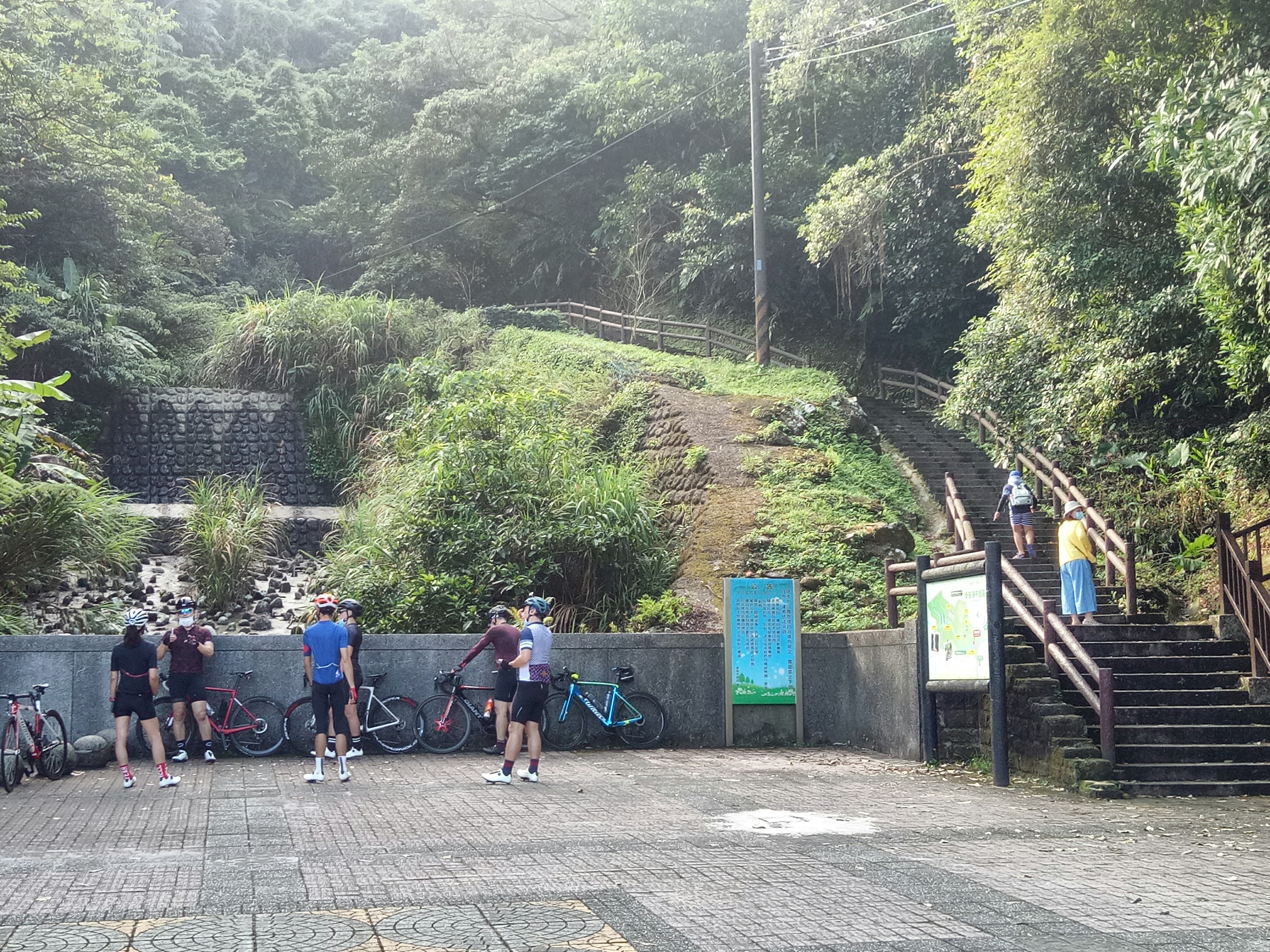
The steps climb to a shelter house and then a little further on the left you can descend to Taian Waterfall.


Its a beautiful waterfall set in a rocky, green alcove with a white column of falling water.


After seeing the waterfall I returned to the shelter house area. Just past and on the left, steps with a fake bamboo railing climb the hill.

I kept to the left and walked a few meters to the trailhead: a dirt trail climbing into the forest on the left.


This is a very nice trail that follows a sometimes-dry stream and climbs to the top of a ridge in about ten minutes.
At
the top of the ridge there is a crossroads. The path straight ahead
goes down to Jiangziliao Waterfall.

To the left there are two paths heading along the ridge toward Mt. Jiangziliao. A sign pointing in this direction says Mt. Qiweilun which is a small peak on the way. Its about an hour and a half from this point to the summit of Mt. Jiangziliao.


It took the second and lower trail but they rejoin after a short distance.
There is soon a fork. The path to the summit is on the right. A metal sign with an arrow says Jiangziliao Shan in Chinese.

This trail was very pleasant to walk. It was generally wide and passed through forest with a dense undergrowth of ferns. Occasionally, I emerged into exposed grassy areas but mainly the trail climbed steadily through forest. A small clearing along the trail is the summit of Qiweilun Shan (389 meters).


There is one side trail heading down on the right but the path to the summit is to the left and stays on top of the ridge. A small sign on the tree pointed left toward Jiangziliao Shan.


Eventually the path joins some steps. The steps are part of a more popular route to the summit that comes from a parking lot at the bottom. It seems most people drive, climb up from there and then go back down. It was only in this section and on the summit that I saw many other hikers.

I followed the steps, which on a flat section gave way to a wide dirt path, to the summit.


As I got closer there was thick grass on the hillside and a few dead trees. The summit has several viewing platforms and a 360 degree view.


There was lots of insect life at the top: butterflies, bright orange flying beetles and dragonflies. There were lots of people on the summit and even quite a few kids. There was a nice breeze and it was not too hot. When I had last hiked this trail in April the summit had been unpleasantly hot and we had not stayed long.
After taking in the view and having something to eat. I took the path on the right just past the first viewing platform. This trail follows a ridge and eventually descends to a road and a Fu Xing Temple (Fu Xing Gong) and an area called Panshiling.
It took about 2 hours to walk from the summit to the temple.

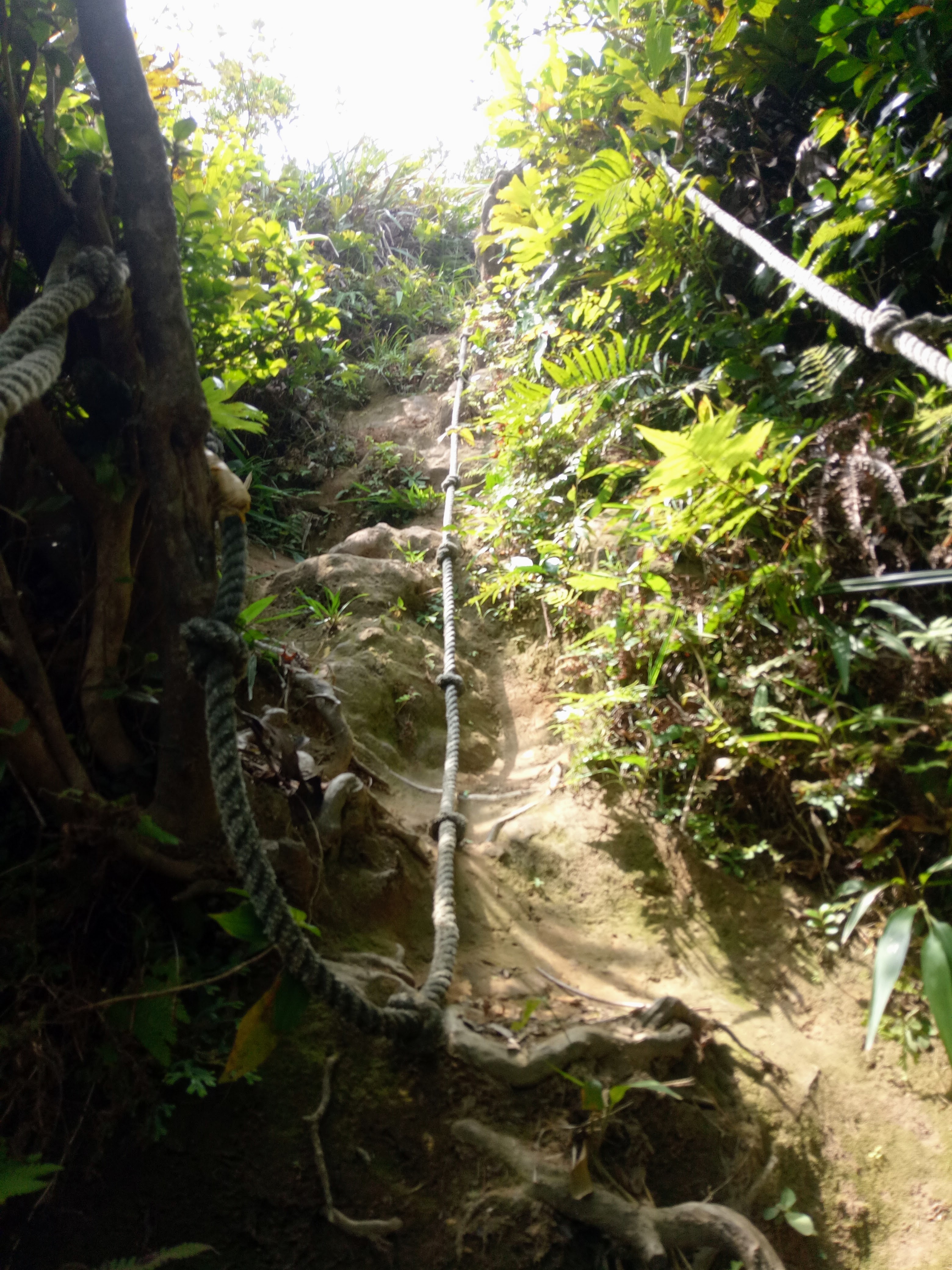
This trail right away was much more rough and narrow than the path on the way up. It was also a lot more overgrown than it had been back when I was last here in April. I only saw three other hikers on the way to the temple.

At first I walked through areas of high grass but soon entered the forest. The trail alternated between dense overgrown sections and wider, shady sections. There were several steep parts to climb with the aid of ropes.

At a T-intersection I turned left and continued toward Fu Xing Gong Temple\Panshiling.

There is one intersection with a bright yellow sign. A there-and-back side trail on the left goes to another summit but I continued straight.

A small clearing marks the summit of Shikeng Dalun (645 meters).


There were a few good views on both side and I could hear traffic on the road. There were a few more steep and narrow places to negotiate.
The trail eventually comes to a small clearing. Looking down I could see the road far below. A trail on the left drops very steeply down the hill—almost vertical at first. There were ropes to help and good places to put your feet.


For anyone nervous about climbing down such a steep slope it looks like a much longer but gentler path continues straight ahead and down to the road. But I took the shorter, steeper route.
The trail comes out at a concrete track. I went left and stopped for a rest at a stone table.

The concrete track descends to a road.

Turning right took me to the temple. Just across the road from the temple is the path onward—a very wide dirt path that is the beginning of the Jingtong Gu Dao (Jingtong Historical Trail). Be sure to take the first, trail and not the second one.

Soon there is a smaller path that goes off to the right and later another to the left. But I stuck to the main path until I came to a path on the right with wooden steps climbing the hill.


This turn was a little tricky. The obvious path seems to go straight ahead but to stay on the historical trail turn right up the steps. The last time I had come here I had walked by the turn and had to backtrack. The path going forward does rejoin the trail later but is longer.
At the top of the steps the path turns into a nice rocky, dirt path. I followed this trail all the way to Jingtong sometimes with a stream on the right.

Along the way I came to the Devils Cave—which is actually a remnant of the coal mines that this area was once famous for. I went into the cave with my headlamp. It was very muddy and wet inside. After a bend I could see the exit on the other side. Its possible to walk through but I went back to the trail.

A short distance after the cave the path joins steps going downhill.

I followed these till I came to another set of steps heading left and downhill. A sign says west parking lot.


Follow these, keep right when they emerge at a parking area and follow a tunnel like road.

This road goes past some houses.

Then continues downhill,

Until it comes to steps on the right that drop down to the railroad tracks.

After crossing the tracks and I was in the village of Jingtong.

There was a shop and food vendors and lots of daytrippers. There were spacious, very clean toilets. I went in and changed into some dry clothes for the trip home.
Then there was time for a bite to eat and a Taiwan beer before taking bus 795 back to Muzha.
GPS coordinates and map:
Taian Waterfall: 25.070042, 121.716953
Jiangziliao Shan: 25.053297, 121.730083
Fu Xing Gong Temple: 25.040436, 121.716624
Jingtong: 25.023978, 121.72387
https://my.viewranger.com/track/details/MjA4OTk0ODk=


