Distance/Time:
Day 1: 13.5 km/ 3 hours 42 mins. More details as well as a map here
Day 2: 19 km/ 5 hours 11 mins. More details as well as a map here
The Trail:
This is a moderate hike. The hike to the campground from Wulai is not difficult but is long. The trail climbs gradually uphill on the way in but its mostly level. However, walking this far with a backpack filled with camping gear is not entirely easy either.
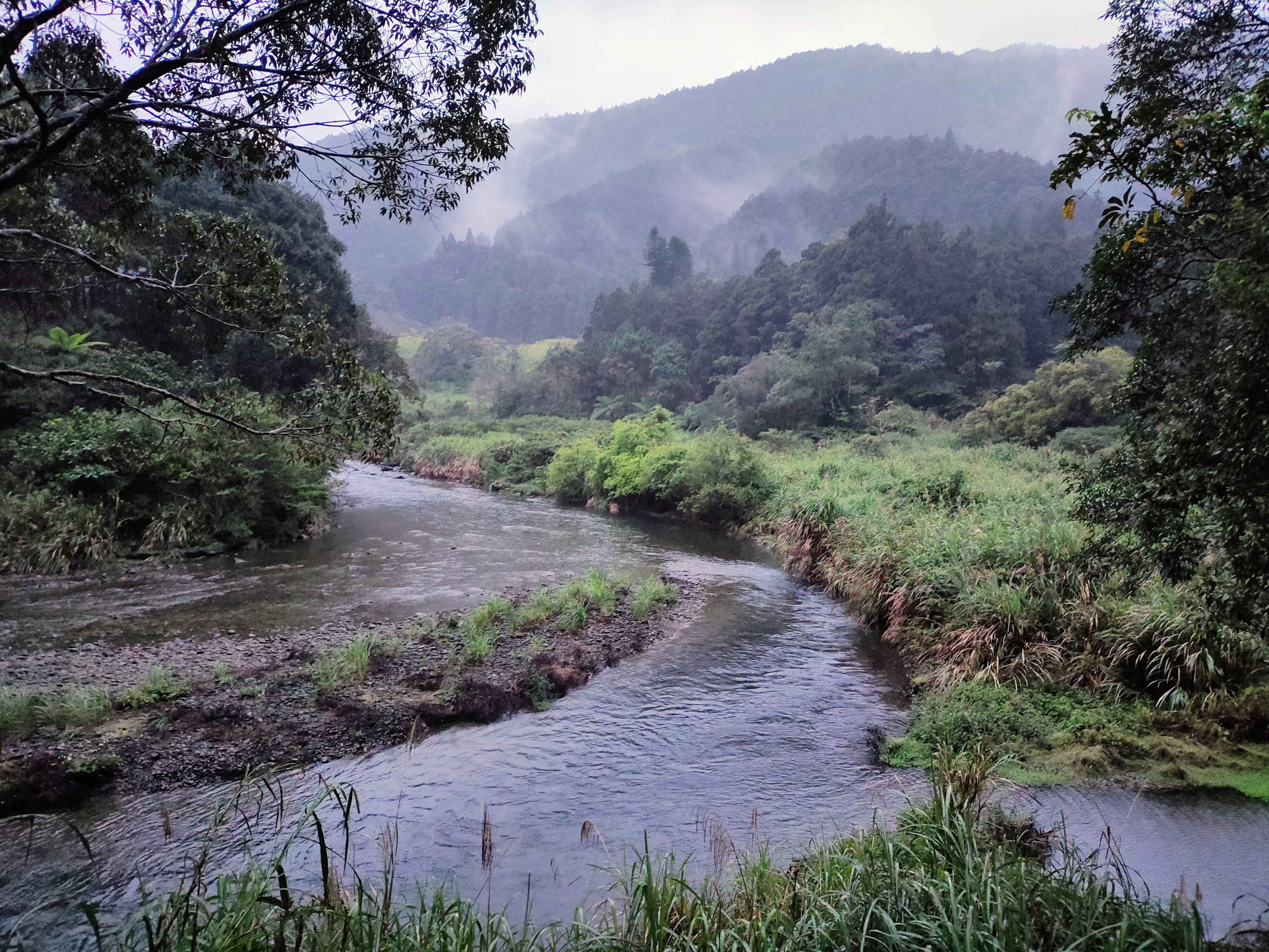
The road is sometimes paved and sometimes gravel and dirt. All along there are great views of mountains and the Tong Hou River. I read that this road was originally intended to connect to Yilan but it was abandoned to protect the river from contamination. At the village of Xiaoyi there is a manned traffic barrier. A sign says that only cars of local residents with business in the area are allowed to pass as well as local taxis but they cannot "stop" or honk. Some hikers climbing Dajiaoxi Shan 大礁溪山 take a local taxi from Wulai. Others drive to the beginning of the Tong Hou trail on the Yilan side and walk from there.
I returned to Wulai after camping because I needed to get back home sooner but carrying on to Yilan via the Tong Hou Trail is a great option. Here is my post about that hike:
Wulai to Yilan: Ayu Road and the Tong Hou Trail 桶後越嶺步道
What to bring: Nothing special is needed. Of course, if camping overnight bring the usually things for an overnight trip. Provisions can be bought in Wulai but after that, there is nowhere to buy anything.
There are plenty of water sources along the road and near the campground so there is no need to carry much with you.
Transportation:
Bus 849 goes from Xindian MRT Station to Wulai. The buses come every 15 minutes and take about 30-40 minutes. If walking all the way from Wulai it takes about 5 hours to reach the campground.
To save time (an distance) two of us met in Xindian and took an Uber all the way to the village of Xiaoyi which cost $600. There we met another friend who had driven his scooter.
On the way back two of us walked all the way back to the bus stop in the Wulai parking lot.
The hike:
I was expecting some intermittent light rain all day but when I exited the MRT at Xindian it was already raining. My friend and I had some lunch at a convenience store and a beer and bought a few more things for camping (food, beer) at the supermarket. Then he ordered an Uber and we were on the way.
We were dropped off just at the end of route 9 which runs south east from the main tourist street in Wulai to the village of Xioayi. Walking from Wulai to Xiaoyi along the road takes about an hour and 40 minutes. It was raining steadily and we put on rain coats and pack covers.

There were two roads on the right. Even though we had been here before we mistakenly took the lower road first. Some friendly people at a house asked where we were going and pointed us in the right direction. We went back to the intersection and were soon on the correct road which is the higher one.


From here it was about a three hour walk to the campground with the river and mountains on the left and forest on the right. Once in a while a tributary stream ran down a ravine and under the road. The road was sometimes high above the river but often closer to it and there were a few short trails leading down to gravely riverbanks in wide spots in the river. We had to step aside for three or four cars on the road. As one car passed a passenger in the back rolled down the window and politely called out "sorry."


 |
| Just about every hiker stops to take a photo of this remarkable waterfall. |
A little less than an hour later we came to another land mark, a tributary stream with terraced concrete weirs, the topmost one with round pipes piercing it.


It rained most of the time we were walking. It stopped a few times raising my hopes but by the time we reached the campsite just at dusk it was raining heavily.


Just before arriving at the campsite the road appears to split. However the right fork soon leads to a closed gate and the left fork carries on.

Just a few minutes after the fork we came to what we took to be a hydro electric plant.


We had some beers and cooked dinner. I love to turn in early when I am camping so I went to bed but my friends stayed up later talking and listening to music. I had a great night's sleep. I only woke up a few times but whenever I did I could still hear the sound of rain.
I got up at six, walked around a little and went down to the river to collect water for coffee.


It wasn't raining but it was misty and wet and sometimes dark clouds were passing over. We had considered doing some more hiking but because of the weather we had a leisurely morning instead and then finally packed up for the walk back to Wulai which took just over 5 hours.

Subscribe: To get new posts by email you can subscribe here Subscribe or follow Taiwan Hiking Journal on Facebook
Maps and GPS Coordinates:
Beginning of A Yu Road in Xiaoyi: 24.849598, 121.586536
Traffic Barrier on A Yu Road: 24.846098, 121.584463
Tong Hou River Campground: 24.836238, 121.646928
Day 1 http://rblr.co/Ohx4s
.png)
Day 2 http://rblr.co/Ohx53.png)
No comments:
Post a Comment