
Distance/duration: 7.2 km/ 4 hours. We started from the parking lot at the Coal Mine Museum. Taking public transportation and walking from the train station or Shifenliao would add 1.6 km each way and probably another hour.
More details as well as a map can be found here on my ramblr account.
What to bring: Stock up on drinks or snacks before going or before leaving Shifen. I packed a lunch and 2 liters of water and I still had water left over at the end. The weather can be very different near the peak so in cooler months a jacket or sweater is a good idea.
The Trail: The entire trail is surfaced except for the final short trail to the peak and radar station. The traction was good. I only encountered a couple of slippery areas--mostly near the beginning next to the stream. There is a temple and two other shelters and there are several benches.
The trail climbs all the way to the peak and then all the way back down with 647 meters of ascent. There are some steep parts but overall its not that hard. There are two peaks on the way up that are both just a few meters off the main path: Dingziliaoshan (550 m) and Wufenshanxifeng (740 m)
Route finding is very straight forward. Just stick to the main path and follow the signs.
It's possible to drive to the top and just walk about ten minutes to the peak but that is not nearly as much fun as walking. I'm also told by friends who cycle that it is a good ride.
Transportation: My friend drove and we started our hike at the parking lot for the Coal Museum but you can take Bus 795Shifenliao from Muzha MRT Station to the Shifenliao stop.
There is more than one 795 route so be sure to get the one going to Shifenliao. On weekends the bus departs Muzha about every 30 minutes between 6:40 and 9:00 and less frequently later. You can check the times on the BusTrackerTaiwan app.
You could also take the train but I prefer the bus since you have to change trains at Ruifang.
Subscribe: To get new posts by email you can subscribe here Subscribe or follow Taiwan Hiking Journal on Facebook
The walk: I have known about Mt. Wufen for about as long as I have been in Taiwan. It's a well-known trail but for some reason I had never hiked it before. My friend, Laurent, had also never been there so we made a plan to meet and finally do it.
When we arrived at the Coal Mine Museum parking lot it was sunny and warm. There are toilets next to it.

From the bus stop walk to Shifen Old Street and cross the tracks so that you are on the far side of the tracks and turn right (Northeast). From there follow Shifen Street as it turns away from the tracks and crosses a stream until it comes to a parking lot. Next to the parking lot (on the left) is a trail that passes under and later runs next to the highway and leads to the Coal Mine Museum.
Facing the end of the parking lot (with the toilets on the left and the museum on the right) we walked along a road. Around the first bend there were big red letters in Chinese and an arrow on an overpass indicating the trail was to the right. We went right and came to a paved stone path with steps.


The first part of the path follows a stream. It is very shady: pretty and enjoyable. There are some interesting foot bridges, a small waterfall with pot holes, some pools deep enough for wading, and right next to the path, a big water slide. We reached the water slide after about 20 minutes.

 |
| Potholes formed by the grinding motion of sand and gravel |


 |
| big water slide on the Mt. Wufen trail |
After this came a long trudge up steps.

And more steps.

After 25-30 mins we came to an Earth God (Tudigong) temple which is a good spot for a rest. There are benches and a view.

Just past the temple there were two trails on the left: one going uphill and one going down. The uphill trail leads, in just a few meters, to the summit of Dingziliaoshan (545 m).


We went back to the main path and continued. We had been on a shady path overhung with trees but now the vista opened with decent views. This part of the trail reminded me somewhat of paths in Yangmingshan National park.


A side trail marked by a wooden finger post led to Wufenshanxifeng (740 m). Laurent decided to go on while I went to the side summit. It's an unexciting peak reached by a very wet, slippery trail but it's not far-- so worth going to if you are passing by.

Going back to the main path again, I descended a bit and then walked up the final gentle ascent.
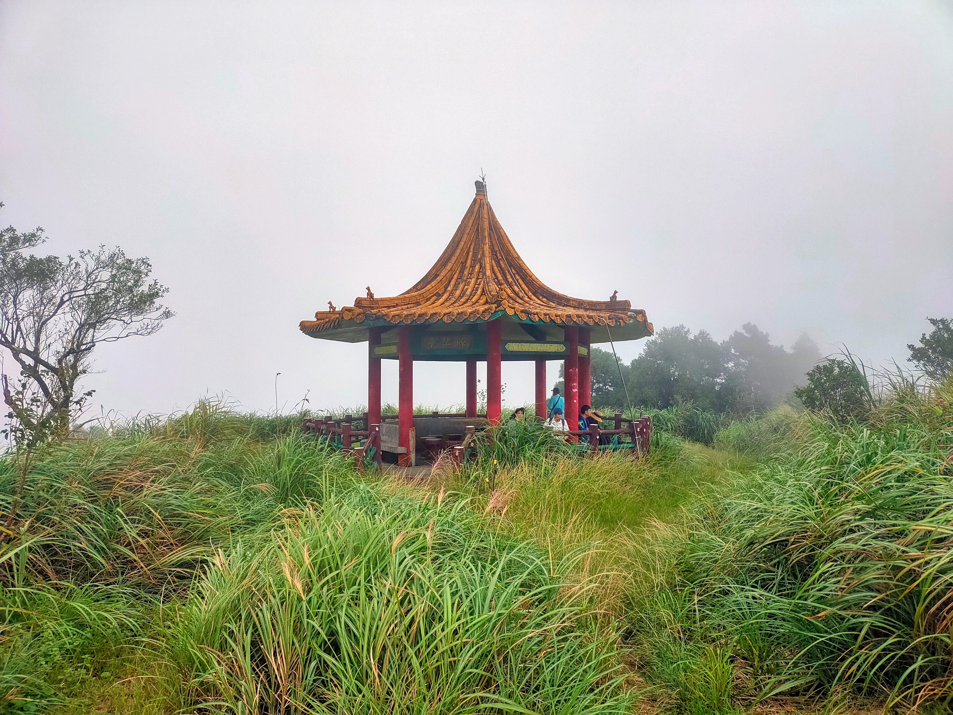
 I passed an ornate shelter house with red pillars and an orange tiled roof. Just a few meters past the shelter is the short trail to the summit which is a narrow dirt path.
 |
| Summit of Wufenshan (740 m) |
Pushing forward through the leaves I emerged at the radar station and caught up to my friend. It was now windy and completely cloudy.

We could see Keelung Harbor from the radar station but there are better views from the road below. We went back out to the main path, turned right and walked for just a few minutes to reach the road.


We went back to the shelter house and had lunch. There was a clearing on the other side of the shelter that seemed to be a look out point. However, by this time the clouds had covered everything. It was what they call in Chinese a bai qiang or "white wall."
We had a nice chat while eating lunch and then heading back down the way we had come. To be honest the trip down was kind of monotonous but it was downhill and went fast.
When we came to the Tudigong temple again it was packed with hikers having a late lunch.


Xinliaodacuo 新寮大厝 to Sandiaoling Station 三貂嶺車站 Waterfall Walk
Nuandong Valley Park 暖東峽谷, the Xishikeng Old Trail 西勢坑古道 and Xishi Reservoir 西勢水庫
Nuandong Valley Park 暖東峽谷 and Zhong Yao Jian 中窯尖 Loop Trail
Subscribe: To get new posts by email you can subscribe here Subscribe or follow Taiwan Hiking Journal on Facebook
Map and coordinates:
Coal Mine Museum parking lot: 25.052472, 121.773662, Google maps link
Mt. Wufen Summit: 25.071008, 121.78071, Google maps link
.png)
No comments:
Post a Comment